


CoastMaster Premium Northeast Coastal V1
Overview
FEATURES
- Compatible With
- All SOLIX® units, all APEX™ units and all XPLORE™ units
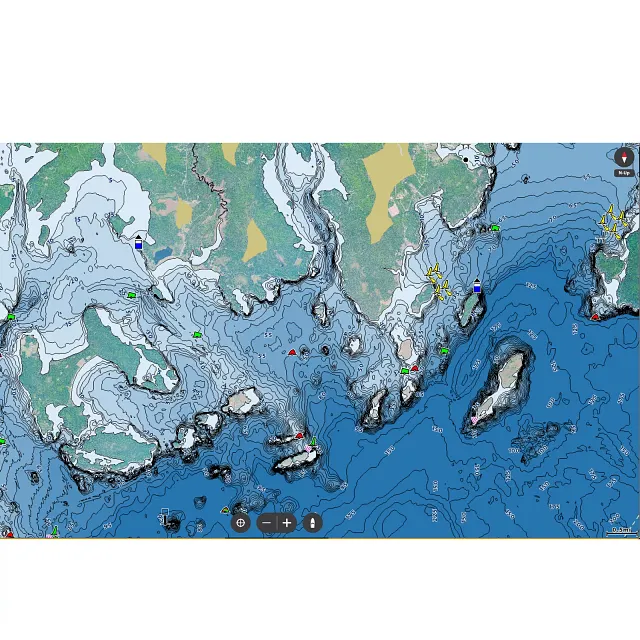
- 2D Shaded Relief
- Make bottom detail and depth changes easy to spot so you can quickly identify fish holding areas.
- Aerial Imagery
- Navigate more confidently and find new fishing spots with the help of aerial imagery.
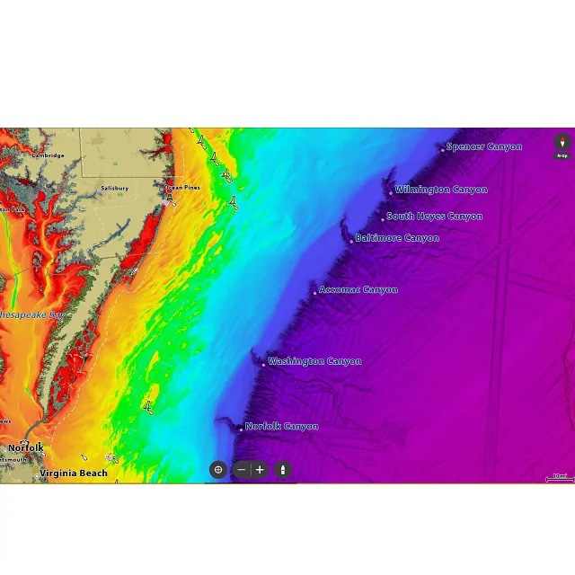
- VX Technology
- Provides exceptional map performance and customizable color palettes.
- Chart Presets
- Simple and easy to change between your own custom view settings.
- Depth Highlight
- Highlight a selected depth range so you can target productive water and stay where the fish are.
- Shallow Water Highlight
- Shallow Water Highlight: Easy-to-see red shading highlights shallow water areas on an adjustable range from 0 to 60 feet.
- Water Level Offset
- Synchronize the depth contours and shorelines of your LakeMaster charts with the actual water levels of lakes, reservoirs and rivers.
- One-Boat Network®
- Connect your Humminbird CoastMaster® chart and Minn Kota® trolling motor, allowing your boat to automatically follow a depth contour line.
- Warranty
- 1-Year Cartography Warranty. Opened packages are not eligible for return.
SPECS
| General | |
| Model | CoastMaster Premium Northeast Coastal V1 |
| Product Code | 602024-1 |
| UPC | 0082324057977 |
| Region | Northeast |
| Warranty | One-Year Warranty |
| Technical Details | |
| Delivery | SD Card |
| Product Type | CoastMaster |
WHY YOU'LL LOVE IT

SPOT ACTIVE FISH AREAS FAST
2D Shaded Relief reveals bottom detail and depth changes at a glance—so you can find productive zones quickly. (Premium only)

SEE EVERY DETAIL FROM ABOVE
Aerial imagery layers let you explore shorelines, spot access points, and uncover new fishing areas with confidence. (Premium cards only)

GET MORE DETAIL IN SHALLOW WATERS
Auxiliary contours reveal subtle changes in shallow areas to help you pinpoint high-potential fishing zones. (Premium cards only)

PLAN AROUND TIDES & CURRENTS
Predict tides and currents with precision—know the direction, height, and speed so you can fish smarter and stay one step ahead of changing conditions.

LOCK IN ON PRODUCTIVE DEPTH ZONES
Create up to four user-defined depth highlight ranges, so you can easily target productive water and stay in the bite zone.

NAVIGATE & TARGET SHALLOW SPOTS
Adjustable red shading (0–30 ft) helps you avoid hazards and find fish hiding in the shallows.

ADJUSTABLE WATER LEVEL OFFSET
Synchronize the depth contours and shorelines of your charts with the actual water levels, so that your chart will reflect the correct water level.

LOCATE DRYING AREAS
Drying areas are highlighted in green, making it easy to spot low-tide zones and plan your route or fishing strategy accordingly.


