4 Essential Mapping Features on Your Humminbird Fish Finder
By Luke Lovrek - Humminbird
Breaking down the why and how of the most important mapping features on your Humminbird fish finder.
Most anglers will agree that lake contour maps are one of the most important tools on their boat. Accurate fishing maps are essential to locating key drop-offs, offshore humps or flats, river channels, and other fish-holding structure.
Digital GPS maps help you narrow down a body of water so you can focus on quality fishing areas instead of only relying on areas that “look good” above the water.
Advanced Lake Maps for More Success on the Water
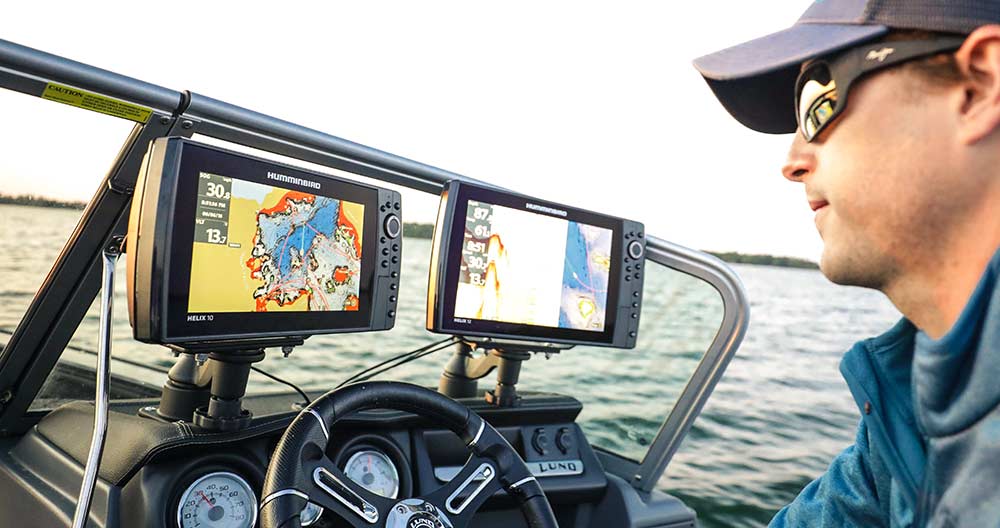
Humminbird’s LakeMaster® lake maps provide an extremely accurate and detailed view of lakes and rivers across the United States. More than 10,000 and counting can be found within the LakeMaster library, spread across North America and parts of Canada – with new waters being added every year.
Over 2,200 lakes are mapped in High Definition (HD) by Humminbird’s own team of GIS cartographers. These HD lake maps include 1-ft depth contours and provide the most accurate survey data available – not to mention aerial imagery, providing visibility to docks, vegetation, and emergent structure (available on LakeMaster PLUS cards).
Not only does LakeMaster provide unrivaled accuracy and detail, but it also provides unique features within your Humminbird fish finder that allows you to break down water like never before.
Let’s jump into the first three features, unlocked by adding a LakeMaster card to your Humminbird fish finder. Finally, we will finish up with a unique feature that allows you to create custom maps on your HELIX or SOLIX fish finder.
#1 - Humminbird Depth Highlight
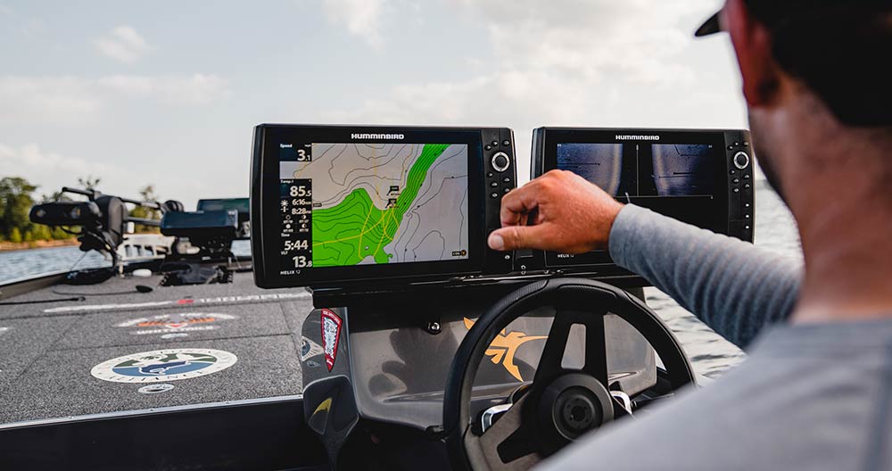
Depth Highlight allows you to select and highlight/shade contours in a particular depth range, so you can easily target productive water and stay in the strike zone.
Why you should use Depth Highlight
The biggest benefit is that depth shading allows you to narrow down a body of water and hone in on the areas that will get you the most bites.
Have you ever had a great day on the water and felt like you really dialed the bite in? That hot bite probably involved catching fish in a specific depth range or a particular area of the lake or river. Depth Highlight allows you to zero in on the strike zone so you can focus on productive depth ranges.
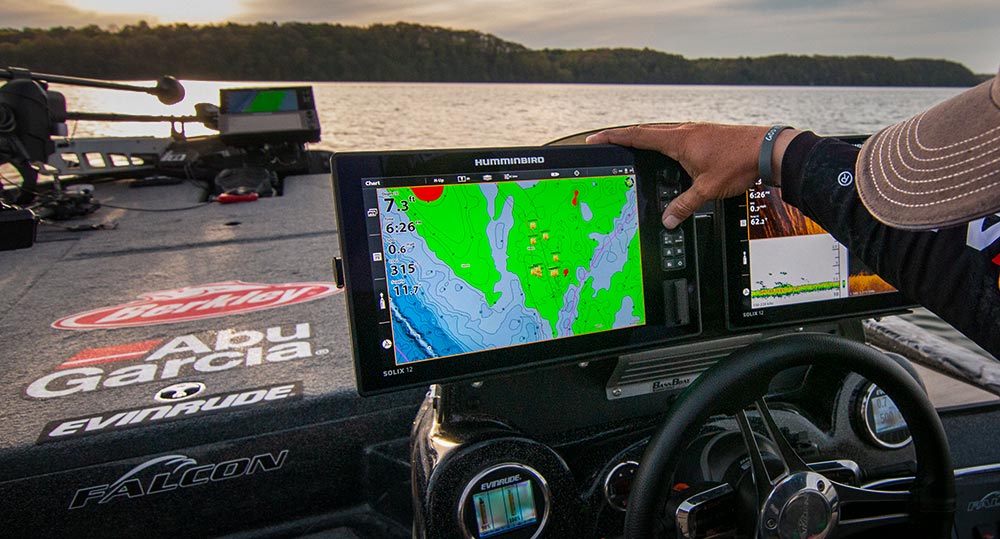
Depth Highlight works extremely well as a visual cue for identifying other areas on the map that set up similar to the successful areas. Some examples would be mid-lake structure that is easily overlooked, points that extend out farther than others, steep drop-offs, vast shallow flats, and the list goes on.
For example, largemouth have been making the move up deep water points in roughly 12-16ft. Depth shading allows you to highlight this depth range on all areas of your map – allowing you to focus on the productive water.
#2 - Humminbird Shallow Water Highlight
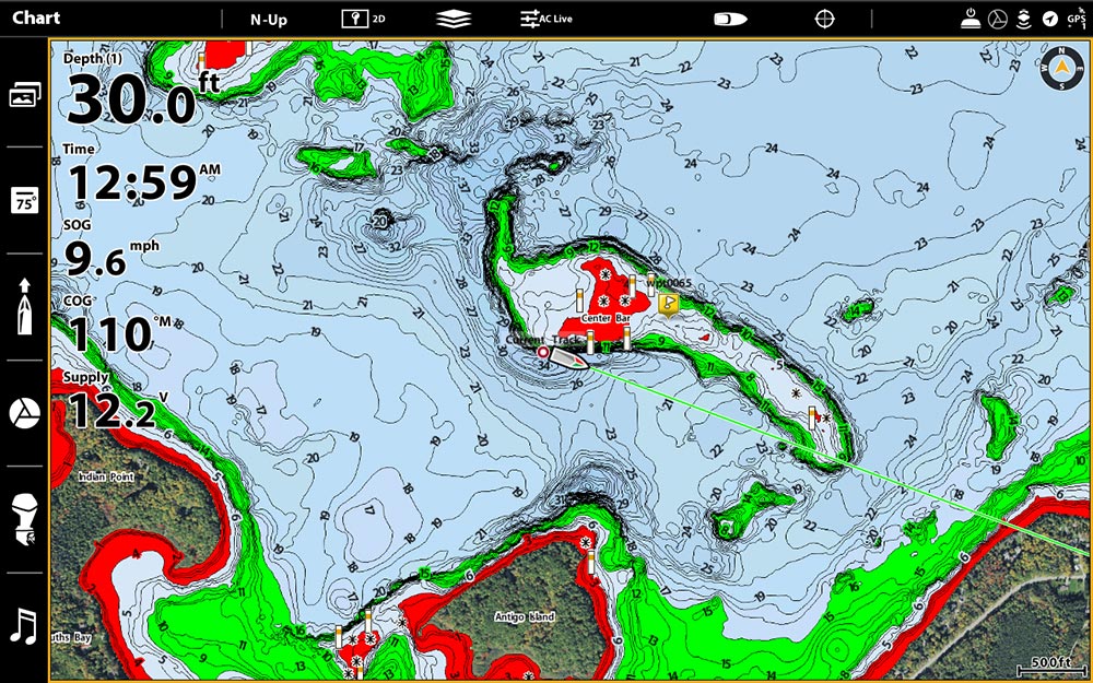
Shallow Water Highlight is an easy-to-see shading of shallow water areas on your map that can be adjusted from 0 to 30 feet.
Why you should use Shallow Water Highlight
The primary reason for Shallow Water Highlight is to quickly identify shallow and potentially hazardous areas like sandbars, humps, rock piles, etc. This is critical when traveling at higher speeds and can save you from running aground and causing expensive damage to your prop, lower unit, boat hull, or even worse, injuring yourself or others in your boat.
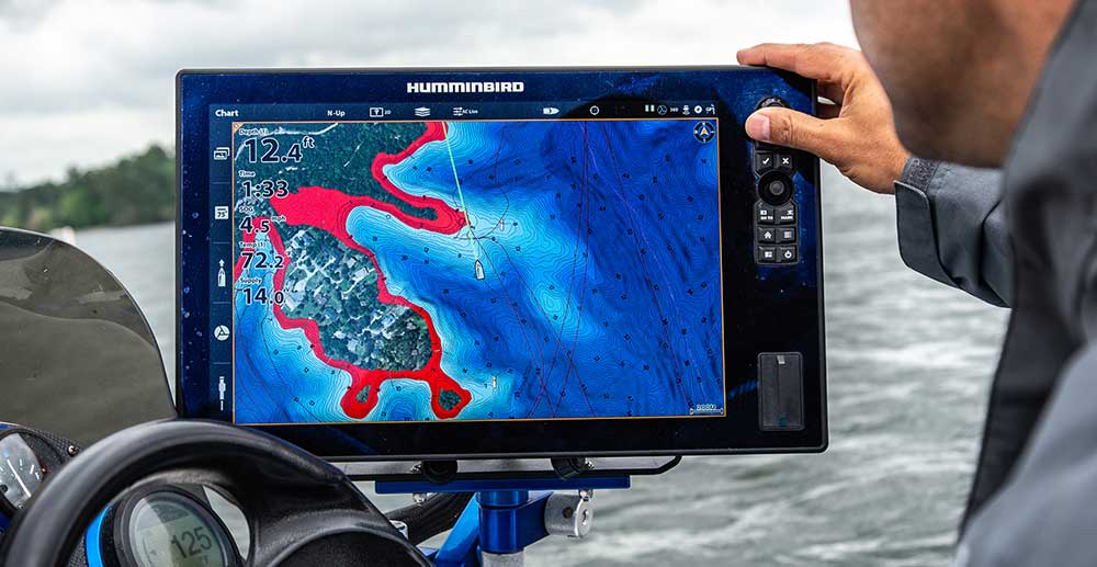
Another popular use of this feature is to use it as a shallow water fishing boundary. For example, if you’re targeting shallow fish, you can set your highlight and use the highly visible red shading as an indicator of areas you should cast into.
This is a popular technique for targeting post-spawn bass that roam shallow points and flats ambushing baitfish and other prey.
#3 - Humminbird Water Level Offset
Water Level Offset allows you to sync the depth contours of your LakeMaster chart with the current water level of lakes, reservoirs, and rivers.
Why you should use Water Level Offset
Safety. Safety. Safety — and seamless fishing experience.
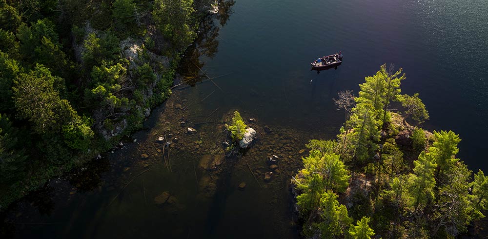
Many bodies of water are regulated by local agencies, resulting in frequent fluctuations in water levels which will affect the accuracy of your mapping. If a body of water is lower than its normal level, that is a significant change that will not only affect your fishing but also your ability to safely travel the water.
If you use the Shallow Water Highlight feature previously mentioned, it is critical that you use Water Level Offset to ensure your chart reflects the true water level. If the water level is 3-ft low and your Shallow Water Highlight is set to 5-ft, it would actually be highlighting 2-ft and less under the current conditions – which could make travel dangerous.
The same can be said for Depth Highlight (Feature #2). If your map is off by a few feet, you will in return, highlight an undesirable depth range – putting your boat in the wrong position for your fishing presentation.
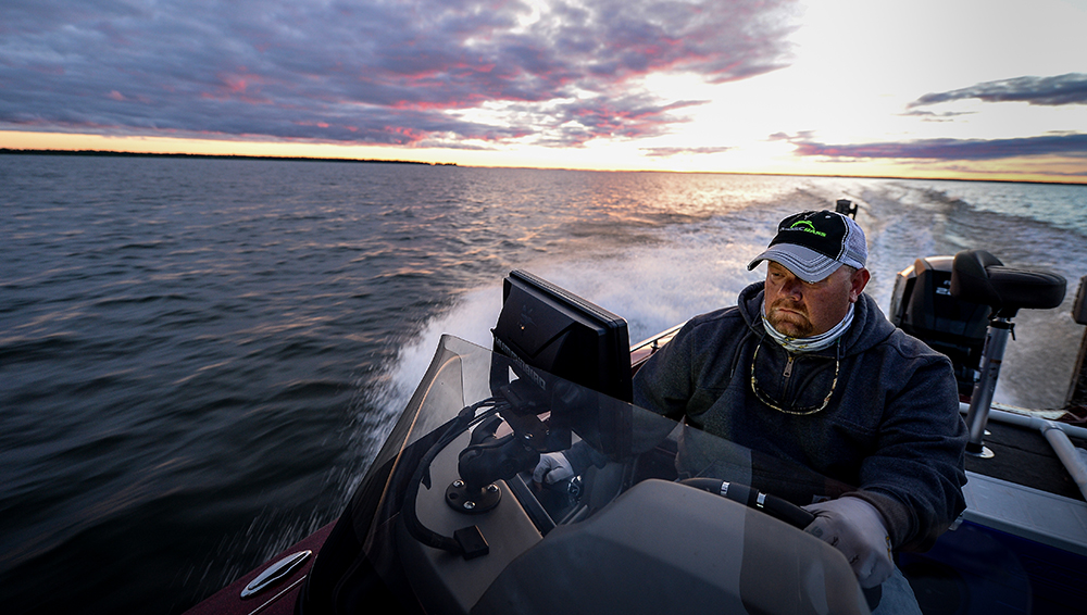
Also, if a lake’s water level is below its normal levels for example, it may bring mid-lake humps or submerged structures into play that may not have been in the strike zone before.
How to use Water Level Offset
The first step you should take is researching local agencies for water levels. An example would be the Army Corps of Engineers or the U.S. Geology Survey (Water Level Data), which monitor water levels of many reservoirs and governmentally managed and surveyed bodies of water. There are also a variety of websites out there that provide similar information.
LakeMaster maps are set to full-pool water levels. Utilizing information from sources above determine the adjustments needed (+ or -) for your map. For example, if water levels are 8-ft higher than full-pool, you can adjust your map’s water level to +8-ft for an accurate reading everywhere on the chart.
If you cannot find public information on water levels, another option would be to idle around a few areas and document the difference between your map readout and your Humminbird’s digital depth reading. From there you can adjust your Water Level Offset like shown in the video below. Recommended only on a LakeMaster High-Definition (HD) bodies of water with 1-ft contour lines.
#4 - AutoChart® Live Custom Mapping
Last but definitely not least is AutoChart Live. AutoChart Live allows you to create detailed custom contour maps of any body of water. It combines GPS coordinates and sonar readings to build a custom 1-ft contour map in real-time.
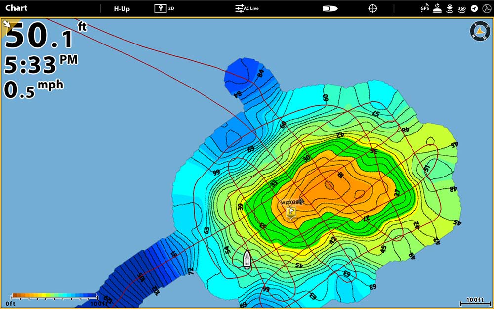
Why you should use AutoChart Live
The biggest benefit of AutoChart Live is that it provides you with detailed contours and depth information of bodies of water that either have a basic contour map or no chart at all. Beyond depth contours, it also provides the ability to view overlays of vegetation and bottom hardness changes.
This has given power to anglers all around the world to have detailed charts. Whether you fish in ponds, lakes, rivers, or oceans, you will have an advantage over other anglers in your area.
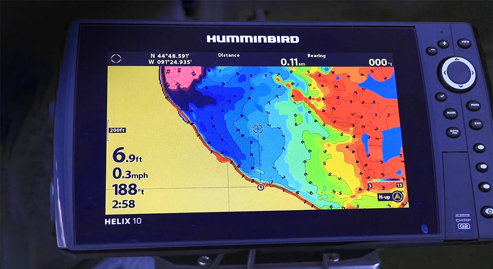
After creating your custom chart, features #1-2 mentioned above are fair game. AutoChart Live maps allow you to identify shallow areas and hone in on key fishing depths with Shallow Water Highlight and Depth Highlight.
Couple that with the ability to show map overlays of hard bottom and vegetation and you have quite the custom mapping solution. Check out this video on locating weeds with AutoChart Live.
How to use AutoChart Live
AutoChart Live a free feature available with all SOLIX and GPS-equipped HELIX G2 (and newer) models. Here are a couple of tips for creating a good AutoChart Live map.
- Charting. Typically, it is best to zig-zag back and forth in a pattern to ensure you’re covering the whole area at different angles and directions.
- Detail. AutoChart Live data is as accurate as you want it to be. The more you drive your boat over an area, the more GPS and sonar information is gathered by your Humminbird unit, meaning the more accurate your data will be.
- Speed. There is no scientific number for what speed you should cover an area, but know that slower speeds allow for better sonar coverage. A good baseline would be 1-10mph – depending on your boat.
- Data Storage: Humminbird fish finders come equipped with eight hours of AutoChart Live data to your fish finder’s internal hard drive. For years of recording, you will need a AutoChart Zero Line SD Card. This card lets you record, export and share your favorite fishing spots with your friends, if that is something that interests you.
Ice fisherman – AutoChart Live is now available in Ice Fishing Mode. Learn more about how to use AutoChart Live Ice.
Get the most out of your lake maps and charts
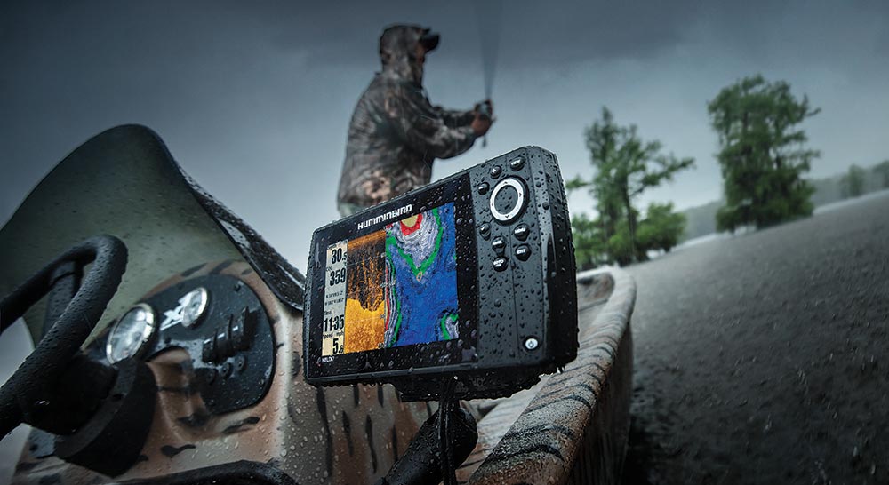
We hope that this has shed some light on ways for you to get the most out of your Humminbird fish finder functionality and LakeMaster map cards. Implementing these simple features can make a difference between a decent day on the water and a great one.
If you'd like to learn more about Humminbird's high-definition LakeMaster Mapping, visit https://www.humminbird.com/learn/mapping/lakemaster.

See the links below for more information on the products and features listed above and some we didn’t get to talk about.
Resources:
All Humminbird Mapping Solutions – See all mapping technologies offered by Humminbird
LakeMaster High Definition Lake Maps – The best freshwater charts on the market
LakeMaster Video Gallery – Watch the latest videos about LakeMaster mapping
AutoChart Live – Create your own custom maps
AutoChart Live Video Gallery – Watch the latest videos about AutoChart Live
ZeroLines SD Card – Record more AutoChart Live data
One-Boat Network – Navigate your boat with your trolling motor via your fish finder
FishSmart Mobile App – Bring high-definition lake maps to your mobile device.